No edit summary |
No edit summary |
||
| (4 intermediate revisions by the same user not shown) | |||
| Line 1: | Line 1: | ||
| − | |||
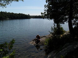
[[File:Ralphbice.jpg|thumb|left|400px|courtesy algonquinmap.com]] |
[[File:Ralphbice.jpg|thumb|left|400px|courtesy algonquinmap.com]] |
||
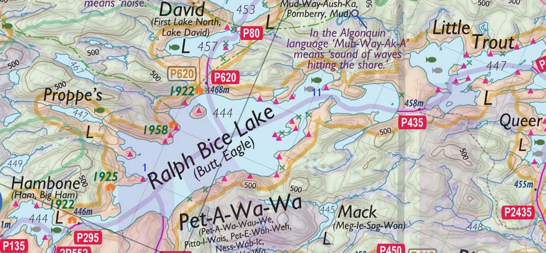
| + | '''Ralph Bice Lake''' is accessible from the Algonquin Park entrance #3 on Magnetawan Lake entrance via Hambone Lake - about 1 hour canoeing and portaging to enter the lake. |
||
| + | It is connected by portages to Hambone Lake, David Lake, Little Trout Lake and Daisy Lake. |
||
| Line 16: | Line 17: | ||
| + | '''11. '''This campsite is located towards the north-east end of Ralph Bice Lake at 45°42'24.97"N, 78°55'48.09"W. |
||
| + | [http://maps.google.com/maps?q=loc:45.706894,-78.930042&output=kml Open in Google Maps] |
||
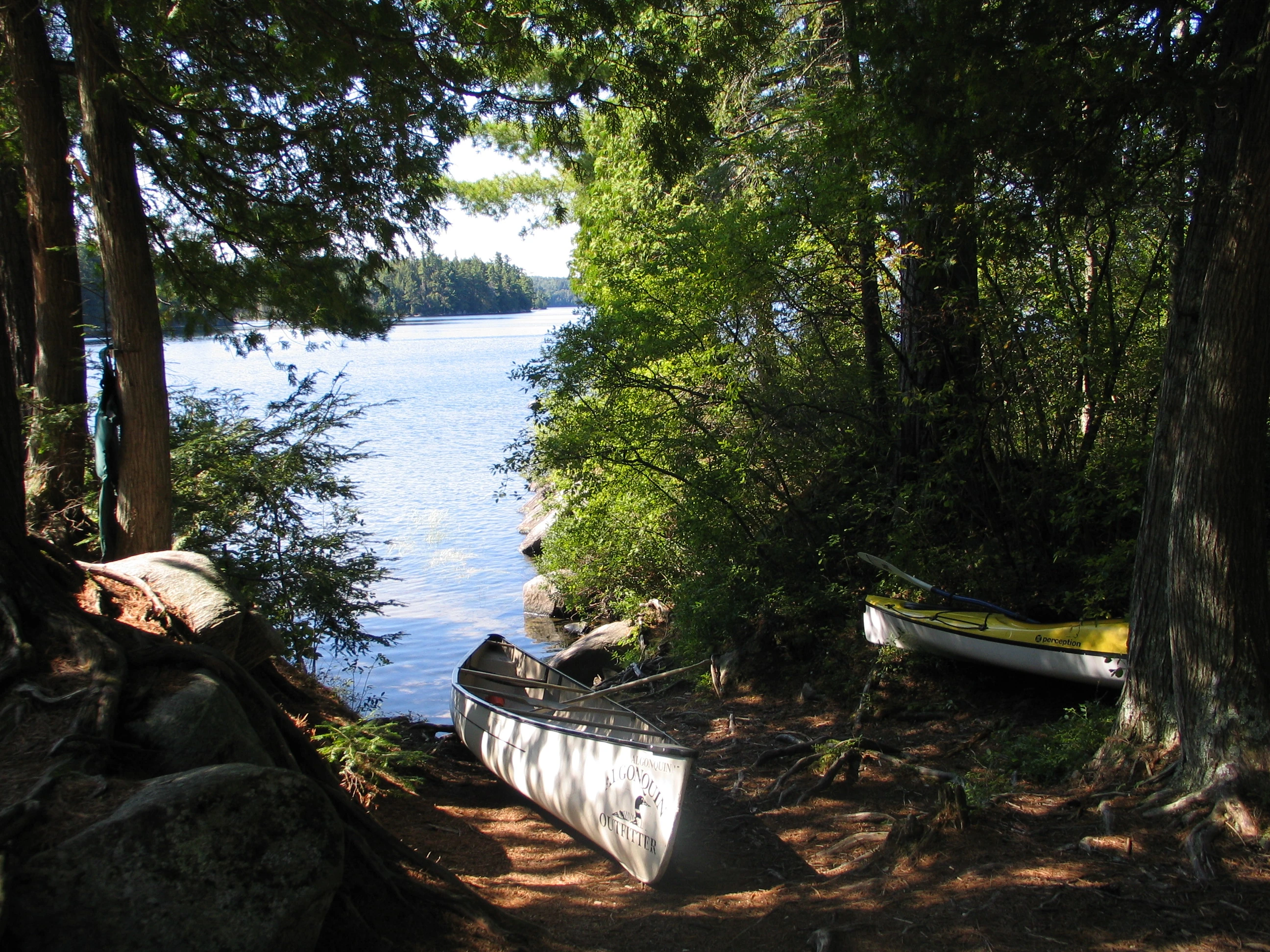
| + | [[File:IMG_6697.jpg|thumb|250px|the narrow sandy harbour]] |
||
| − | |||
| − | |||
| − | |||
| − | '''11. '''This campsite is located towards the north-east end of Ralph Bice Lake at 45°42'24.97"N, 78°55'48.09"W. [[File:IMG_6697.jpg|thumb|250px|the narrow sandy harbour]][http://maps.google.com/maps?q=loc:45.706894,-78.930042&output=kml Open in Google Maps] It's accessible from the Algonquin Park entrance on Madawaska Lake entrance through Hambone Lake - about 2 hours canoeing and portaging. |
||
At the tip of the point is a nice little narrow bay with a sandy bottom that you can canoe into to land your canoe, but you'll have to step high onto some roots to get up to the main campsite. It's easier than coming in off the rocks to the south. |
At the tip of the point is a nice little narrow bay with a sandy bottom that you can canoe into to land your canoe, but you'll have to step high onto some roots to get up to the main campsite. It's easier than coming in off the rocks to the south. |
||
| − | |||
| ⚫ | |||
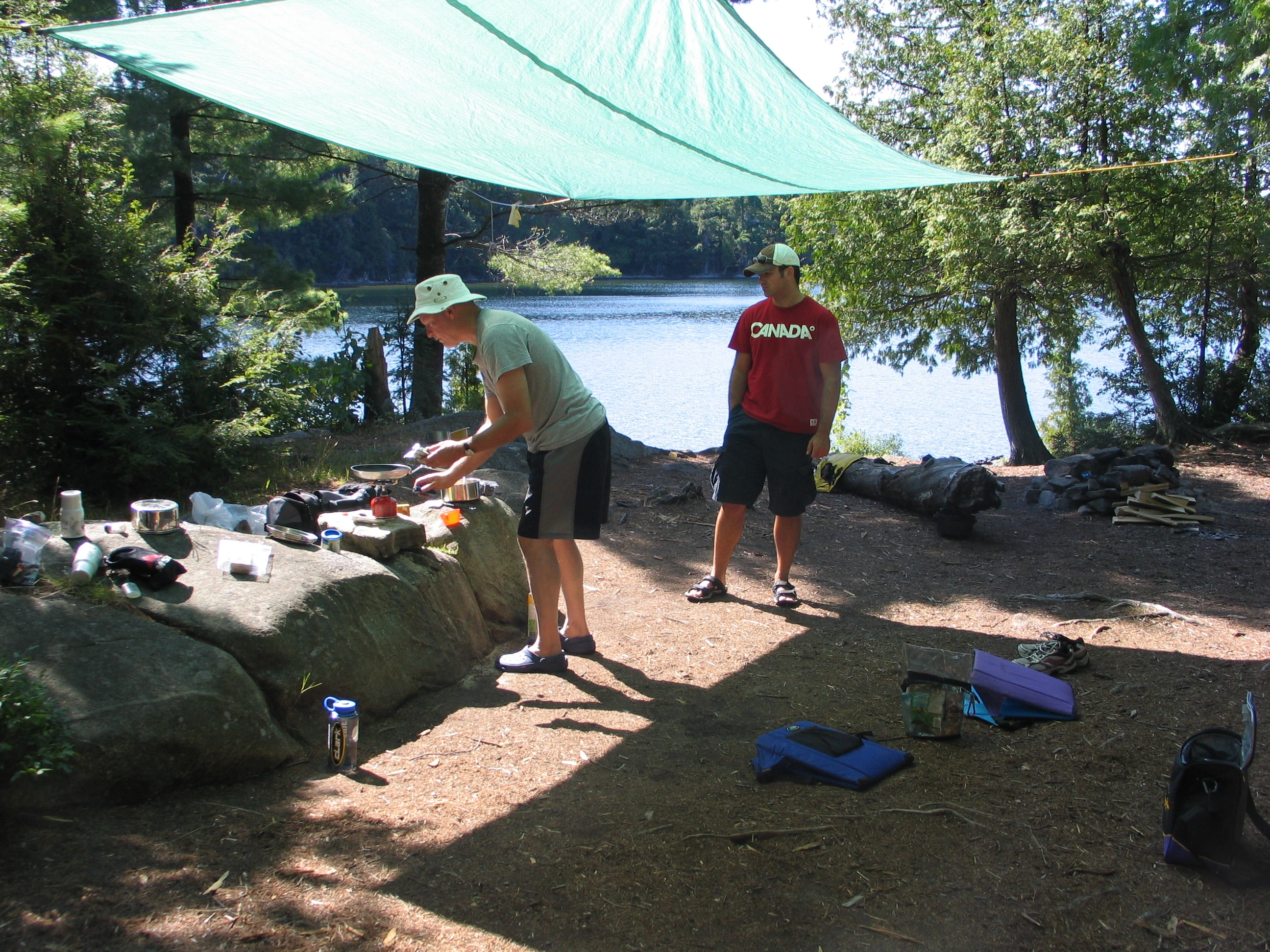
[[File:IMG_6696.jpg|thumb|left|250px|the large rock makes a good "table"]] |
[[File:IMG_6696.jpg|thumb|left|250px|the large rock makes a good "table"]] |
||
| ⚫ | |||
It must be a busy site as you have to got far in to the woods to find firewood. |
It must be a busy site as you have to got far in to the woods to find firewood. |
||
| − | There's a small, flat rock at the north side of the site (just beyond the large fallen tree) that gives you a nice sunset view and NW exposure for stargazing. A large sloping rock on the south side is great for sunning and water access. Swimming is good off |
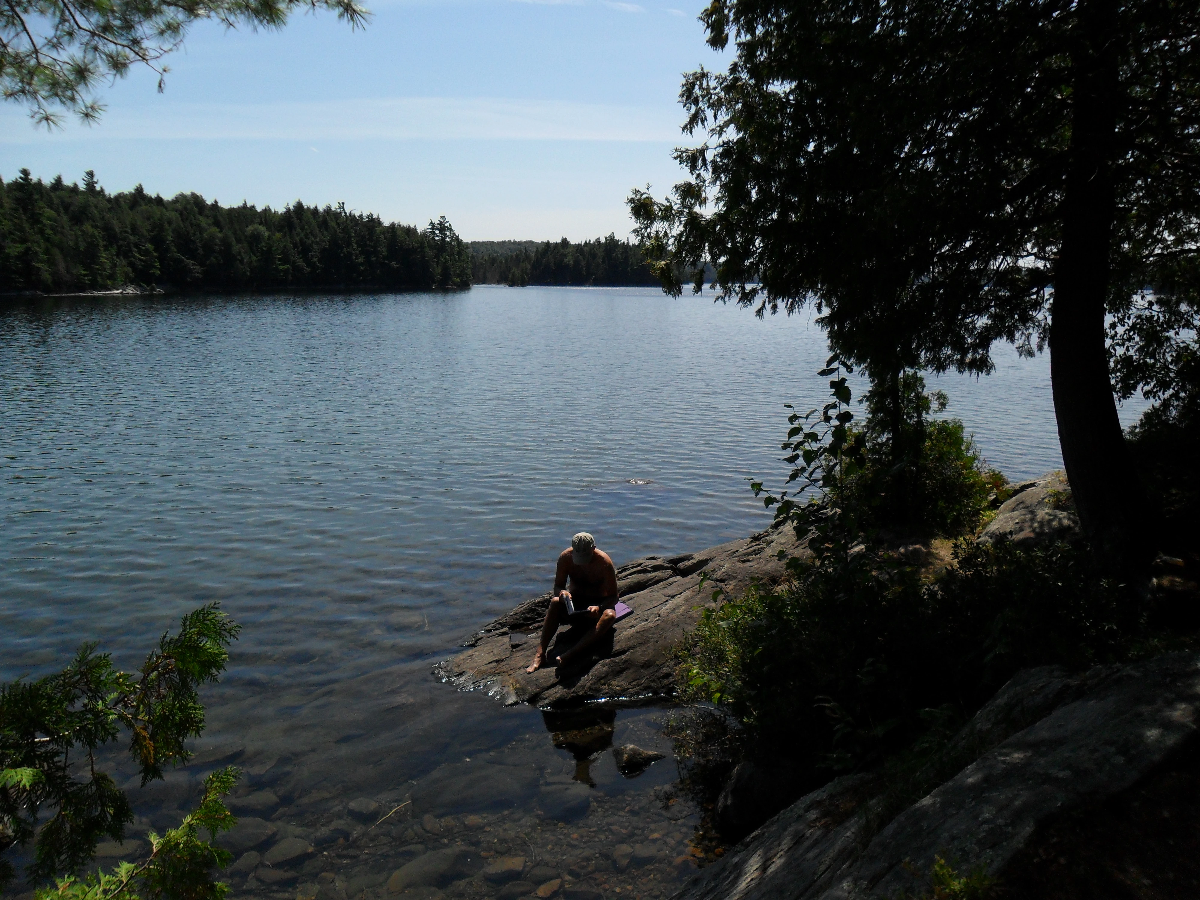
+ | There's a small, flat rock at the north side of the site (just beyond the large fallen tree) that gives you a nice sunset view and NW exposure for stargazing. A large sloping rock on the south side is great for sunning and usable for water access. Swimming is good off this rock, but be careful - the water is shallow. Don't dive in.[[File:SAM_0029.jpg|thumb|250px|The sloping rock on the south side]] |
There are several flat places to pitch a tent further into the woods. |
There are several flat places to pitch a tent further into the woods. |
||
| − | Rating: 4/5 pine cones |
+ | '''Rating''': 4/5 pine cones |
[[Category:Campsites, Ralph Bice Lake]] |
[[Category:Campsites, Ralph Bice Lake]] |
||
Latest revision as of 01:23, 2 September 2010
courtesy algonquinmap.com
Ralph Bice Lake is accessible from the Algonquin Park entrance #3 on Magnetawan Lake entrance via Hambone Lake - about 1 hour canoeing and portaging to enter the lake.
It is connected by portages to Hambone Lake, David Lake, Little Trout Lake and Daisy Lake.
11. This campsite is located towards the north-east end of Ralph Bice Lake at 45°42'24.97"N, 78°55'48.09"W.
Open in Google Maps
the narrow sandy harbour
At the tip of the point is a nice little narrow bay with a sandy bottom that you can canoe into to land your canoe, but you'll have to step high onto some roots to get up to the main campsite. It's easier than coming in off the rocks to the south.
the large rock makes a good "table"
The fire pit is located in a large open area. There is a large knee-high rock near the fire pit that you can use as a "table" for meal preparation. It must be a busy site as you have to got far in to the woods to find firewood.
There's a small, flat rock at the north side of the site (just beyond the large fallen tree) that gives you a nice sunset view and NW exposure for stargazing. A large sloping rock on the south side is great for sunning and usable for water access. Swimming is good off this rock, but be careful - the water is shallow. Don't dive in.
The sloping rock on the south side
There are several flat places to pitch a tent further into the woods.
Rating: 4/5 pine cones